Esta entrada también está disponible en: Spanish
– Programs to View Glaciers. Through the use of publicly available tools such as Google Earth, anyone can see glaciers, clearly and in 3D from the comfort of their desk! The first thing you need to do is to download Google Earth. You can do this quickly and at no cost at: http://www.google.com/earth/download/ge/agree.html.
You should take a moment to learn the potential of this fabulous tool you can use to get to know our planet. With this tool you’ll be able to see recent images of our earth, in 2 or 3 dimensions, you can view older images, measure distances between objects, you can take altitude readings, compare natural resource and human evolution, mark places you’d like to come back to, measure surface area, and you can even record each and every step of your tour around the world for future use or to share with others! Google Earth offers very interesting tools to learn about our planet.
– “kmz” file. In Google Earth you can insert markers and draw polygons around natural features such as glaciers, or areas that you wish to highlight or set apart. These polygons can be saved individually or collectively just as any other file (they get assigned a “.kmz” extension. You can store these files, group them, edit them, reorder them, exchange them with other users, send them via email, etc. By managing your polygons, you can group all natural resources that you’ve outlined that are related to a given mining project, for instance.
In CHRE’s glacier inventory, we’ve groups some of these polygons and offer them through our website for others to consult. For instance:
- Glaciers in the Aconquija Mountains of Catamarca
- Glaciers in Tucuman Province
- Glaciers in the vicinity of El Pachón (Xstrata Copper)
- Glaciers in the vicinity of Los Azules (Minera Andes) (coming soon)
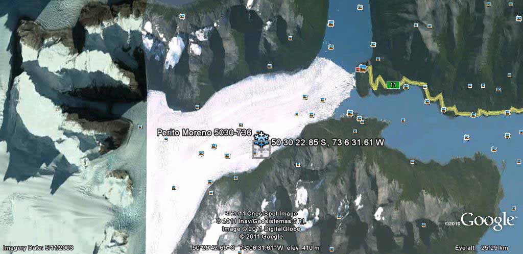
– Geographic Coordinates. The markers that one inserts in Google Earth mark a spot on the map, which corresponds to a geographical coordinate, expressed in measurements that tell you where the point is relative to the earth’s longitudinal and latitudinal lines, in degrees, minutes and seconds. With these geographical references, you know exactly where you are in the world, and if you have them, you can visit the exact geographical point through Google Earth. For instance, the Perito Moreno Glacier, which is one of the world’s most spectacular glaciers and which can be visited by anyone, is located at:
50 30 22.85 S, 73 6 31.61 W
This number tells us a few things. The first part of the coordinate, the “50”, tells us we are at the 50th parallel,of the Earth, and the “S” just before the comma, tells us that it’s the 50th parallel of the Southern Hemisphere, otherwise, the S would have been a N, to indicate the Northern Hemisphere! The “73” tells us that we are at the 73rd longitudinal line, and likewise, the following “W” tells us it’s West of Greenwich, otherwise, the W would be an E, indicating that it was to the East.
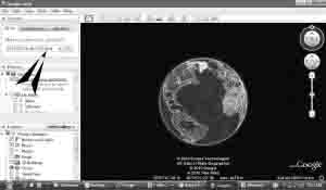
This coordinate site can be copied exactly as is, and pasted in the search box in Google Earth. It is important not to modify the address in any way, including erasing or omitting spaces, commas, etc, as this will generate an error in the search! Paste and “ENTER” will take you to the Perito Moreno Glacier! Have a good trip!
Once you’ve hit enter, the globe in Google Earth will begin to rotate and you’ll be taken to the glacier. You will then see the image below, which may take a few moments to load depending on the speed of your internet connection.
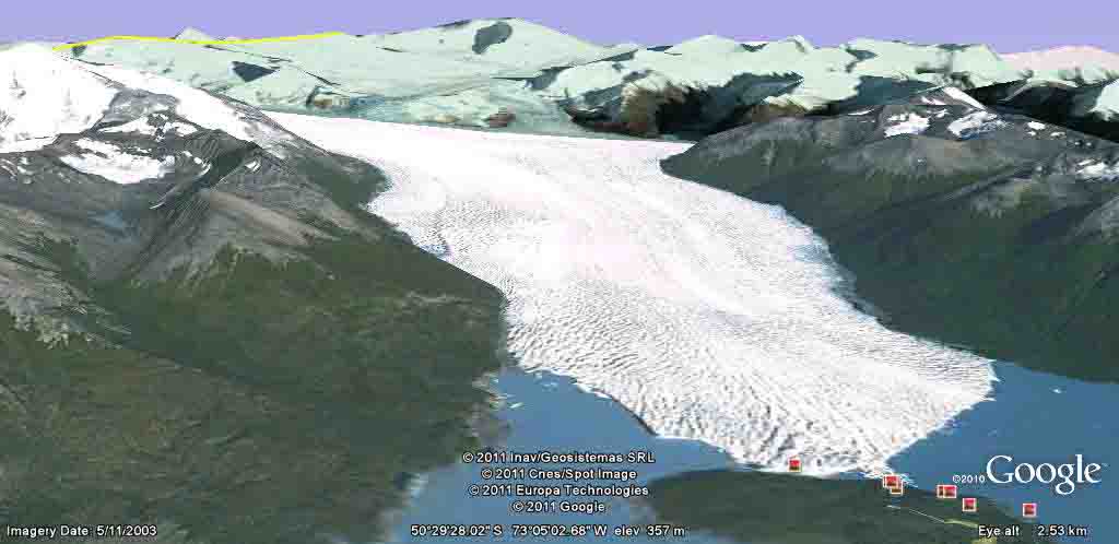
We can also see the image in 3D, quite easily, with Google Earth’s 3D tool, which appears as a compass reading in the upper right corner of the screen. By clicking on the arrows of the compass you can tilt the image, rotate, etc. You can also use the up, down, left and right arrows on your keyboard, or in combination with the crtl key, to obtain the same movements. We can hence view the Perito Moreno Glacier into a 3D position.
– Nomenclature. The location name of the glacier. While a glacier like the Perito Moreno or the Upsala, is very well known to many by their public names, most glaciers do not have names, which makes their common identification difficult. In San Juan Province in Argentina, for example, there are more than 10,000 glaciers. Naming them with names like Perito Moreno would be impossible and not very useful. Scientists have devised ways to identify glaciers, but as is common with science, it’s not very user friendly for the non-expert. This is why CHRE has devised its own simple way to name glaciers, which at the same time, help us identify exactly where the glacier is. Let’s use the Perito Moreno glacier as an example.
The Perito Moreno is at 50 30 22.85 S, 73 6 31.61 W, so we take the first four number of the north/south coordinate, and the first four numbers of the east/west. Keep in mind that the numbers are grouped by degrees minutes, seconds, etc. and so for instance, a single digit number would otherwise have a “0” in front of it. In the Perito Moreno example, this occurs in the east/west side with the “6” , which would be “06”. So for our naming purpose, we only take three digits on the right side, or 73 6.
As such, we call the Perito Moreno Glacier 5030-736. We have not added the S and W indicators because we are working almost exclusively in South America with our inventory, but if we were working globally, we might want to adjust the name to:
Glacier 5030S-736W
If we only had the glacier name, we can still use this address to locate it, that’s the simplicity of the system. If you enter 50 30 S, 7 36 W into Google Earth, and hit enter, you go to a site very near to the full address, but still on the glacier! With this naming system, we can individualize glaciers, and very simply and quickly find them on the map!
In the case that there are more than one glacier near to the marker and to the full coordinate, and that the first four digits are identical, we simply distinguish them in their name utilizing a, b, c, d, … Glacier 5030-736 (a), Glacier 5030-736 (b), Glacier 5030-736 (c), etc.
– References. CHRE’s Glacier Inventory indicates tour seperate referentes for each glacier
- The name of the glacier, determined as we have indicated above
- The full coordinate of the glacier, determined by a marker placed randomly on the surface
- The minimum and maximum altitude of the glacier
- A polygon that draws the contour of the glacier (this is kept separately in a KMZ file)
Lets consider an example of 5 rock glaciers from our inventory that surround the El Pachón (Xstrata Copper) mining project. We’ll use Glacier R 3144-7027 as an example. The “R” specifies the type of glacier (rock) as opposed to an ordinary uncovered glacier, which has no letter indicator.
# Name Coordinates Altitud
| 1 | Glaciar R 3139-7025 (b) | 31 39 7.87 S, 70 25 41.66 W | 3840-3980 |
| 2 | Glaciar R 3144-7027 | 31 44 51.05 S, 70 27 14.47 W | 4023-4250 |
| 3 | Glaciar R 3144-7027 (b) | 31 44 25.08 S, 70 27 28.90 W | 4130-4260 |
| 4 | Glaciar R 3144-7027 (c) | 31 44 40.63 S, 70 27 17.94 W | 4140-4180 |
| 5 | Glaciar R 3144-7027 (d) | 31 44 15.80 S, 70 27 14.31 W | 4095-4150 |
– Latitudes. As a matter of convenience, we’ve ordered our inventory by latitudinal location and by province, so that, for the Province of San Juan, which is located geographically between latitudes 28S in the north, and 32S in the southern most point, we’ve created five separate KMZ files which include glaciers in the 28, 29, 30, 31, and 32 parallels.


